1
/
of
4
Lulabud
US & World Primary Laminated Classroom Map Pack by BrightWay Educational | 36" x 30" Educational Wall Maps | Grades 1-5 | Bright Colors & Large Fonts | Geographical Features | National Capitals & Major Cities (With Flags)
US & World Primary Laminated Classroom Map Pack by BrightWay Educational | 36" x 30" Educational Wall Maps | Grades 1-5 | Bright Colors & Large Fonts | Geographical Features | National Capitals & Major Cities (With Flags)
Regular price
$63.74 USD
Regular price
Sale price
$63.74 USD
Shipping calculated at checkout.
Quantity
Couldn't load pickup availability
About This
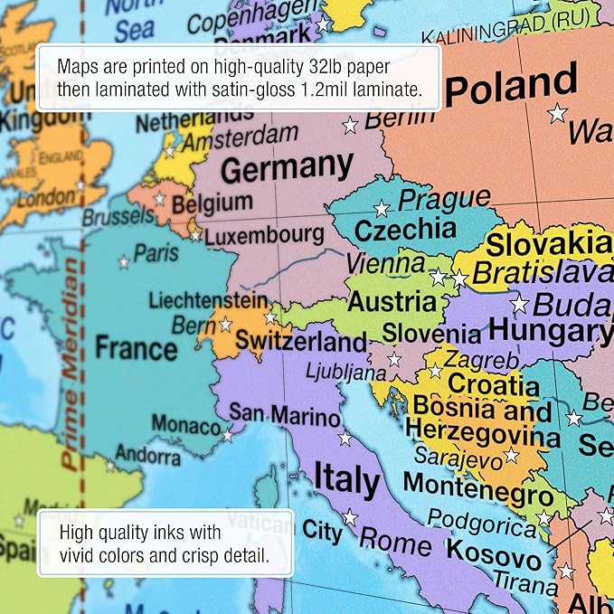
- Includes one map of the United States and one map of the World, each 36' x 30' and laminated.
- Bright, vivid colors clearly define countries and territories, making the maps visually engaging for students.
- Grades 1-5 Focused: Ideal for primary education classrooms, fostering foundational geography skills.
- Large, easy-to-read fonts help young learners quickly identify locations, enhancing readability and retention.
- Georeference and degree lines provide spatial context, helping students understand the global grid system.
- National capitals & global cities are prominently labeled, offering insight into political geography.
- Comprehensive physical features: Explore oceans, mountain ranges, lakes, rivers, and more, offering a full understanding of both political and physical geography.
Overview
- Color : With Flags
- Brand : BrightWay Educational
- Product Dimensions : 36'L x 30'W
- Manufacturer : Map Shop
Share